Keeping History Above Water: Newport Restoration Foundation
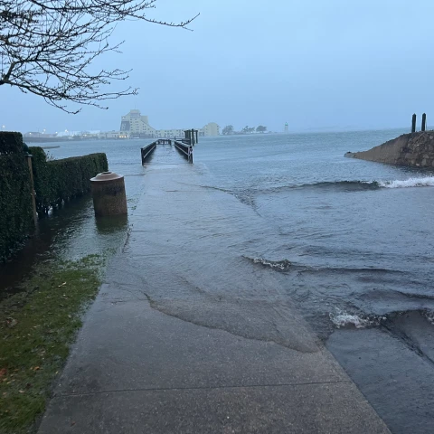
The threat:sea- level rise, flooding, storms and high tides
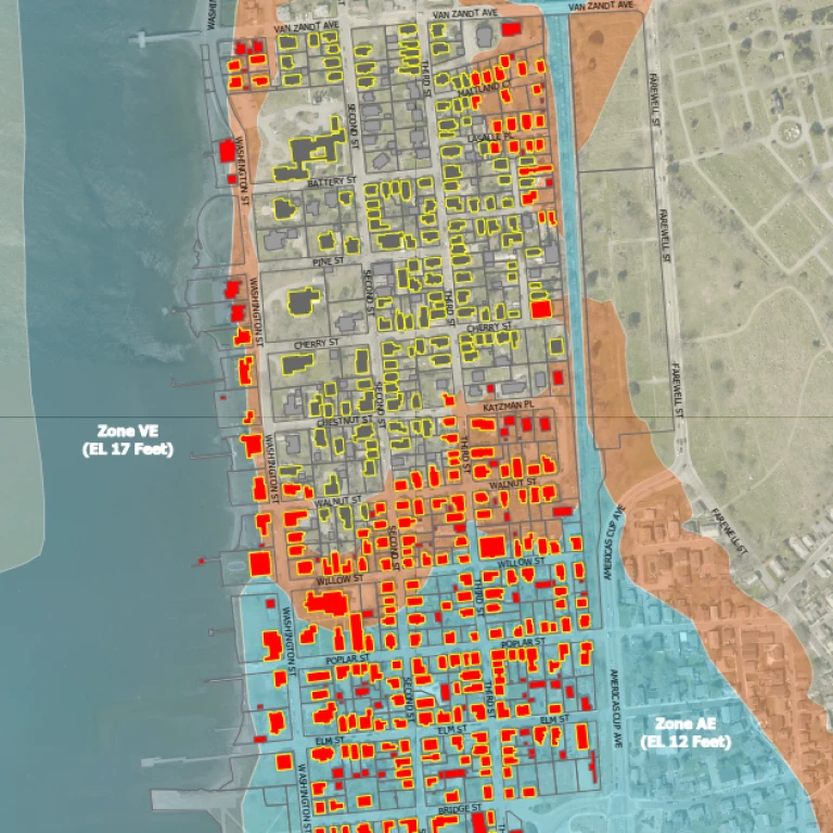
NRF stewards more than 80 historic buildings and landscapes, including 27 rental properties in the Point and Lower Thames neighborhoods vulnerable to inundation and an additional 5 properties facing the threat of 3-5 feet of sea level rise— totaling 46% of NRF’s rental portfolio.
Newport’s neighborhoods are changing in the wake of climate change. Building elevations, flood fortification, and landscape adaptations are shaping the present and future streetscapes of Newport. Alongside the City of Newport’s strategic plan, NRF is actively working towards the resiliency of our portfolio of vulnerable properties.
Assessing vulnerability
In 2021, NRF engaged Linnean Solutions and Built Environment Coalition to assess the organization’s vulnerability to sea level rise and storm surge. The assessment examined several factors:
- RI Coastal Resources Management Council (CRMC) STORMTOOLS provided current sea level rise and storm surge hazard data
- A tenant-steward survey of properties in the FEMA-designated flood zone to understand water infiltration
- Hazard Exposure—where a NRF property is located relative to the flood zone
- Hazard Sensitivity—degree to which a property may be affected by a storm or flood event due to the condition of its foundation, storm windows, cladding, etc.
Combined, these tools provide NRF a clear, data-driven ranking of each property’s current vulnerability to sea level rise and storm surge and with an additional 3 to 5 feet of sea level rise.
NRF updates property condition data and sea level rise projections on a regular basis, as well as qualitative feedback from tenant surveys, to keep vulnerability data current. This data helps us plan for adaptation and resiliency upgrades so that we can continue to steward these properties to the next generation, and beyond.
Elevating utilities in the flood zone
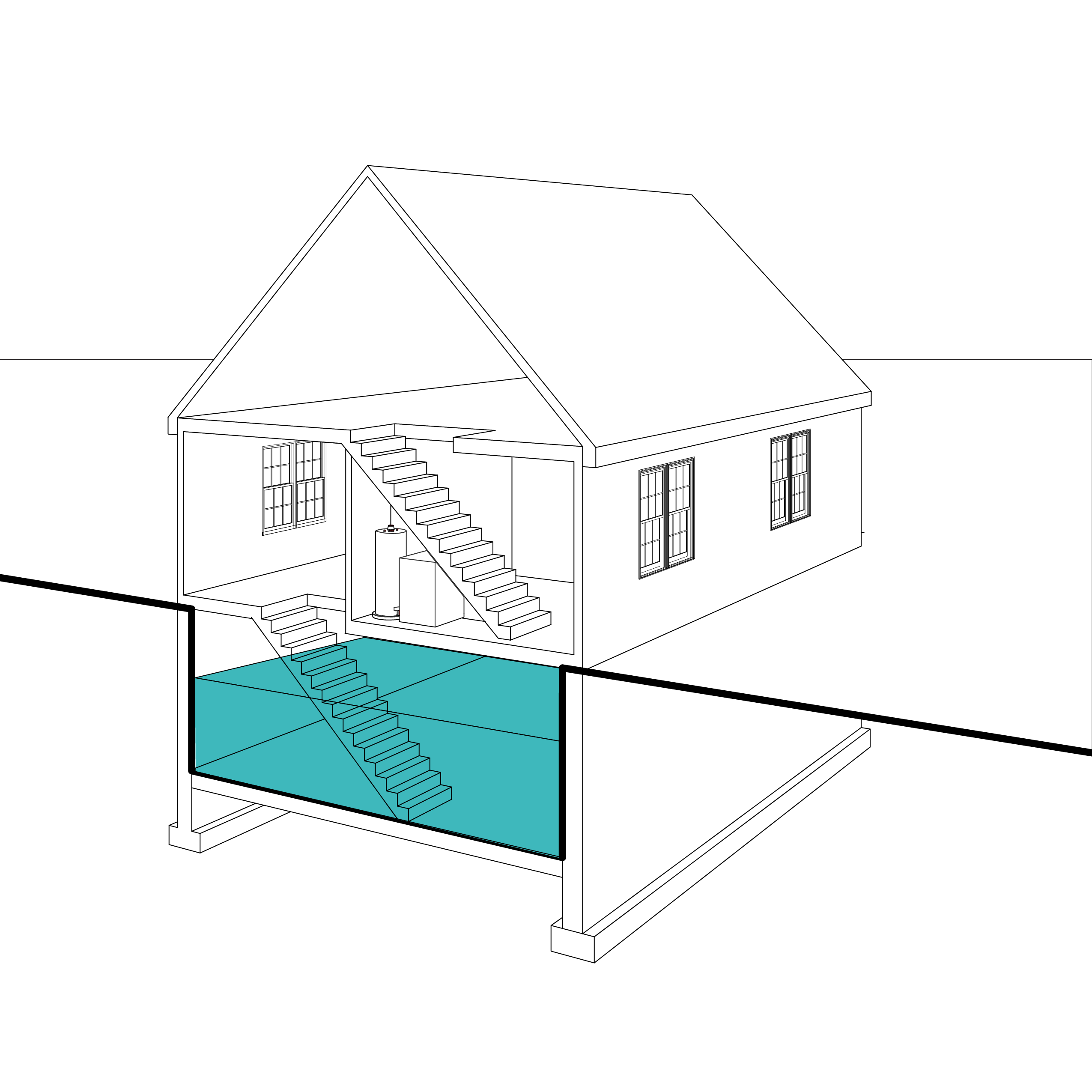
NRF is phasing elevation or fortification measures for utility replacement at rental properties in the flood zone. Sump pumps, dehumidifiers, and flood insurance provide a level of security from storm events, but are not long-term solutions. Given the certainty of rising tides and increased storm events, removing utility assets from low-level spaces provides sustainable, long-term protection.
NRF considers built adaptation to flood events on a timeline relative to expected sea level rise and storm surge events in Newport. This design life timeline considers the payback for an adaptation design given the initial upfront investment. NRF considers adaptations with a design life minimum of 50 years (expected design life to 2075).
Sharing knowledge
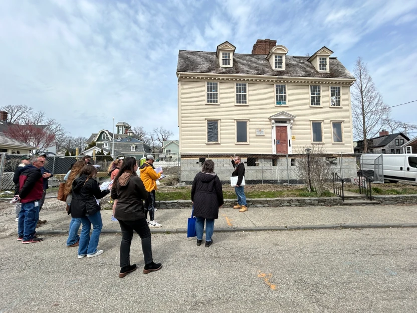
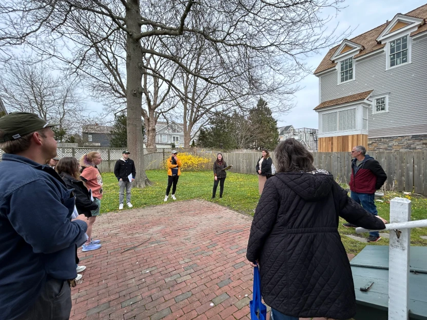
NRF staff share construction and resiliency updates in the Point neighborhood with interested groups through guided walks and conversations.
If you are an organization interested in learning more about NRF’s resiliency adaptation and partnerships in Newport, please contact Margaret at visit@newportrestoration.org
Newport’s Guidelines for Elevating Historic Buildings
Newport’s Historic District Commission (NHDC) has concluded that the best policy for long-term preservation in low-lying neighborhoods is to support voluntarily elevating structures. In January 2020, the NHDC adopted the Design Guidelines for Elevating Historic Buildings. The guidelines apply towards all contributing and non-contributing buildings within the Newport Historic District—a collection of nearly 400 properties. The guidelines include four considerations to guide commission and applicant thinking in reviewing elevation projects for historic buildings:
- Streetscapes and Context Consideration
- Site Design Consideration
- Foundation Design Consideration
- Architecture and Preservation
NRF and the City knew graphic support for the Guidelines was critical for applicants and commissioners to visualize proposed adaptations alongside the written guidelines. Together, NRF and the City successfully partnered on a grant-funded graphics project to highlight appropriate changes to historic buildings undertaking elevation. The visualizations are an important tool for historic homeowners in Newport as well as serve as a model for other historic communities looking to articulate adaptation strategies.
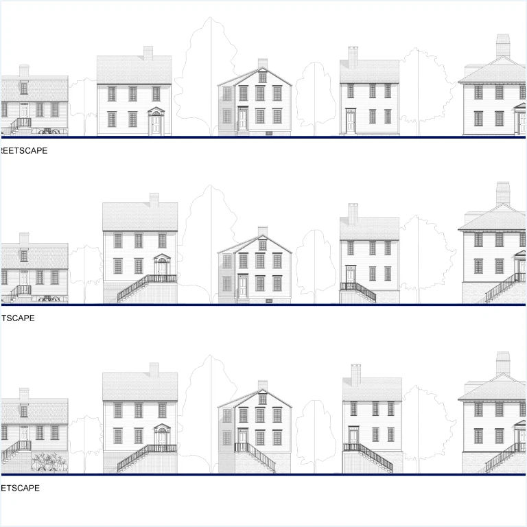
Interpreting change
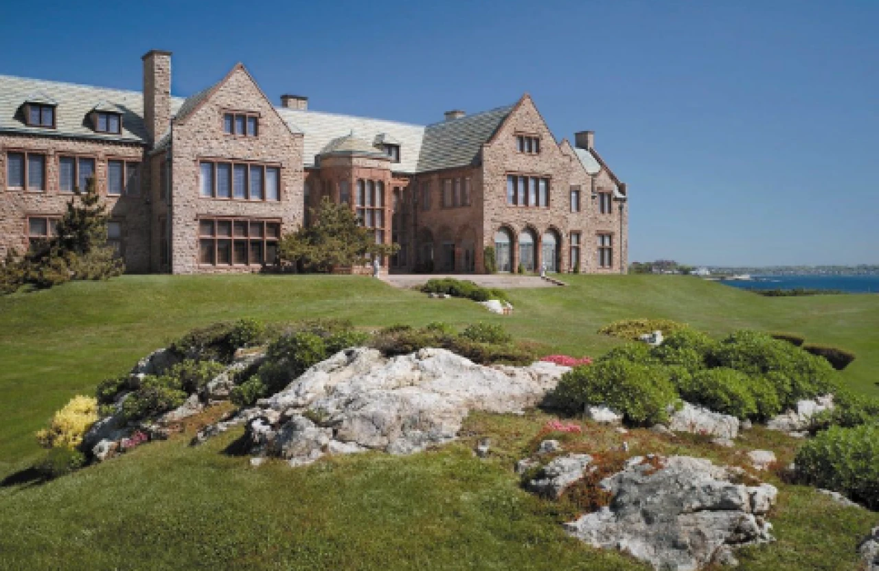
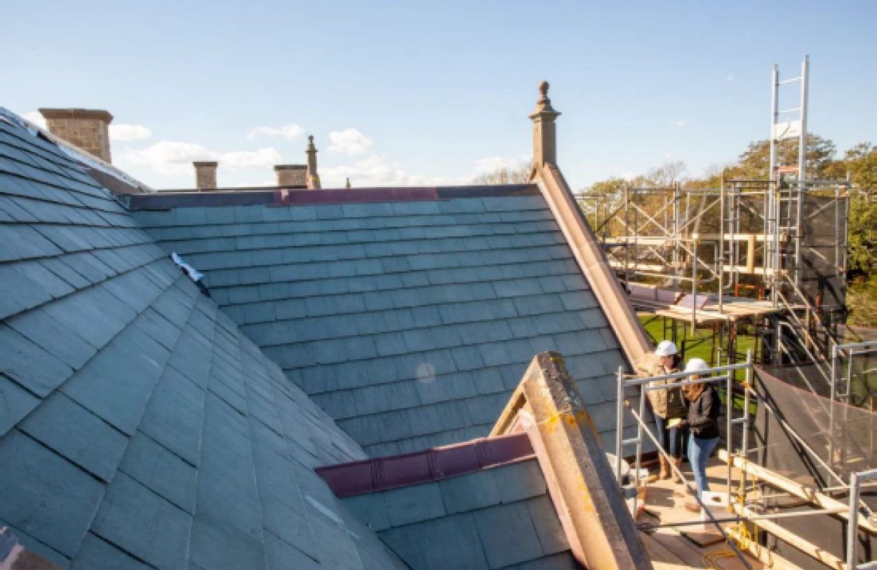
Intensifying storms due to climate change affect all NRF properties, including Rough Point. As part of Restoring Rough Point Phase I (2021-2023), the house’s drainage capacity was increased to better handle intensifying rain and storm events. Visitors to Rough Point learn about the project and NRF’s resiliency work, as well as make connections to the impact of climate change globally.
Landscape adaptations
In Summer 2025, NRF undertook the first-ever landscape surveys of the 70 historic rental properties in the portfolio. Surveys consist of a conditions assessment, inventory, and landscape maintenance best practices for residential properties throughout Newport. The goals of the survey are several-fold: to inventory NRF landscapes, to identify drainage concerns and direct water runoff away from buildings, and to plan for necessary landscape maintenance and drainage solutions. Particularly for the NRF flood zone properties, this survey will highlight opportunities to better divert runoff from entering basements, create stormwater retention areas, and support the growth of native and saltwater resistant plantings.
Stay in touch!
Join the Keeping History Above Water newsletter here

